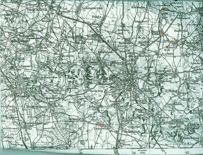
MAP of KANITZ, PETERWITZ,
MASSEL and KLOCH FELDER
To go to a full size, readable version of this map, click here.
But please be patient! This is a large download.
"Look at the bottom of the map
at #423 with Breslau. [this the current city of Wroclow] it is due South of
the Kreis' border. Now travel up and slightly to the West-do you see
Peterwitz? Jim Balder, in his research has some information about the
Balders living in that area. Now go North to the larger city of Trebnitz.
Just North East find both Massel and Kloch Felder, two villages that both
have connections to the Balders. I believe they attended church there. Now,
looking close and North [almost to the top of the map here] locate the
very tiny village of Kol on one side of the river and the village of Kanitz
on the other. This would be West of the village Werndorf. There is the
village--the homeland of our Balder family of Carl and Maria."
--from
Connie Balder Mickolajak in an email dated February 13, 2001.